Sierra Azul Trail Challenge Half Marathon

April 20, 2024
San Jose
Trail
Distances
Half-Marathon
Starting Time

8:00 AM

Fees

$75+

Perfect For

Ready to sign up?

1-100
Extremely Difficult
Park Run
High: 66°
/ Low: 50°

With 26 miles of hiking, walking and running trails that wind through its more than 17,000 acres, the Sierra Azul Open Space Preserve just south of Los Gatos offers a challenging run over a combination of park fire roads and dirt trails for the annual running of the Sierra Azul Trail Challenge, which also features a 5K, 7K, 50K, 20-mile and full marathon in addition to the half marathon.

The course for the race follows an out-and-back route that the organizers describe as “one of the toughest runs out there,” a 6.55-mile run out from the starting line near the eastern edge of the preserve on Hicks Road, all the way to the aid station at the half-way turnaround point, and back again.

Along the way, runners will experience several steep hills and a steep overall elevation gain from the start to the half-way point, from about 1,400 feet above sea level at the start to about 3,000 feet at race’s peak elevation near the turnaround.

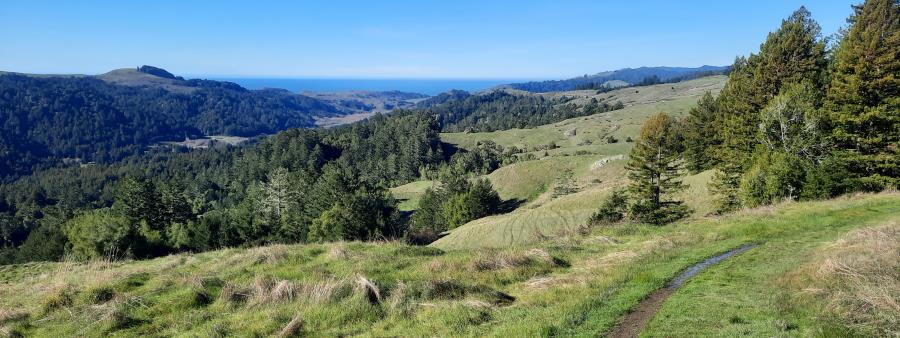
Along the way, runners will encounter a range of environments and terrain conditions, as the preserve varies from wide-open grasslands to densely wooded oak forests, and from hard and rocky chapparal shrub lands to deep ravines and riparian areas, where creeks and streams cut through the forest.
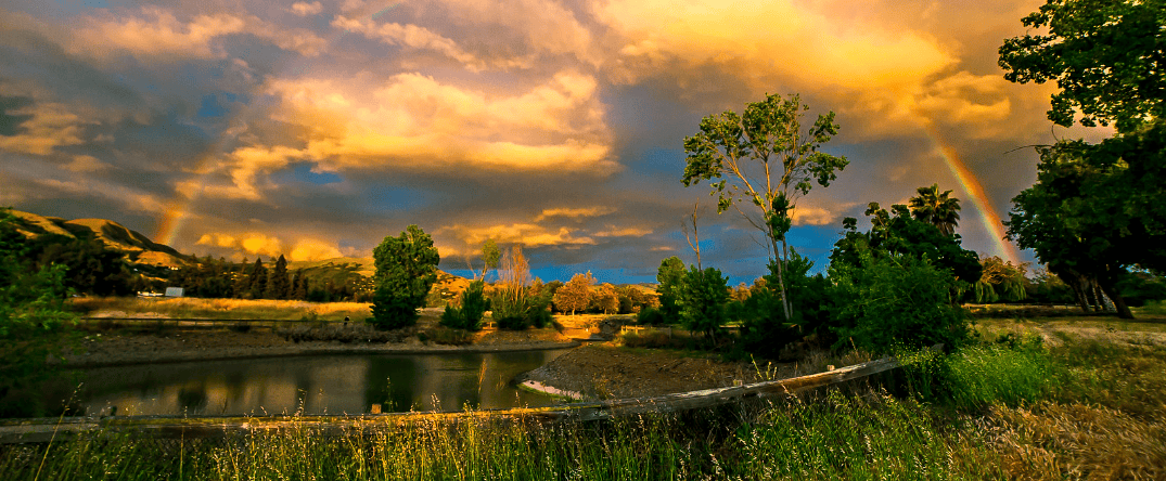
Runners will make their way through the preserve along the Woods and Bay Area Ridge trails, and they’ll be able to see the peak of 3,486-ft.-high Mount Umunhum off in the distance as they run the trails out and back to the finish line. The Sierra Azul Preserve is divided into three zones or areas — the Kennedy-Limekin Area, which is the most popular of the three, in addition to the Cathedral Oaks and Mount Umunhum areas. As they run along the Woods Trail between the start and the turnaround point, runners will be trekking through the Kennedy-Limekin Area, which stretches all the way from the race starting line to the St. Joseph’s Hill Open Space Preserve, all the way near the western edge of the park. Because there is no parking available near the starting line area on Hicks Road, shuttle bus transportation will be provided at Venture Church, which lies further south along Hicks Road. Runners also are asked to be mindful of their impact on the forest and the trails as they run the race, and to spread themselves out into smaller groups during the run to minimize their impact.
Overview
With 26 miles of hiking, walking and running trails that wind through its more than 17,000 acres, the Sierra Azul Open Space Preserve just south of Los Gatos offers a challenging run over a combination of park fire roads and dirt trails for the annual running of the Sierra Azul Trail Challenge, which also features a 5K, 7K, 50K, 20-mile and full marathon in addition to the half marathon. The course for the race follows an out-and-back route that the organizers describe as “one of the toughest runs out there,” a 6.55-mile run out from the starting line near the eastern edge of the preserve on Hicks Road, all the way to the aid station at the half-way turnaround point, and back again. Along the way, runners will experience several steep hills and a steep overall elevation gain from the start to the half-way point, from about 1,400 feet above sea level at the start to about 3,000 feet at race’s peak elevation near the turnaround. Along the way, runners will encounter a range of environments and terrain conditions, as the preserve varies from wide-open grasslands to densely wooded oak forests, and from hard and rocky chapparal shrub lands to deep ravines and riparian areas, where creeks and streams cut through the forest.
Runners will make their way through the preserve along the Woods and Bay Area Ridge trails, and they’ll be able to see the peak of 3,486-ft.-high Mount Umunhum off in the distance as they run the trails out and back to the finish line. The Sierra Azul Preserve is divided into three zones or areas — the Kennedy-Limekin Area, which is the most popular of the three, in addition to the Cathedral Oaks and Mount Umunhum areas. As they run along the Woods Trail between the start and the turnaround point, runners will be trekking through the Kennedy-Limekin Area, which stretches all the way from the race starting line to the St. Joseph’s Hill Open Space Preserve, all the way near the western edge of the park. Because there is no parking available near the starting line area on Hicks Road, shuttle bus transportation will be provided at Venture Church, which lies further south along Hicks Road. Runners also are asked to be mindful of their impact on the forest and the trails as they run the race, and to spread themselves out into smaller groups during the run to minimize their impact.

Train with Runna

Use code HALF for 2 weeks FREE

Sierra Azul Trail Challenge Half Marathon Course Map

Distances
Half Marathon
Starting Time

8:00 AM

Fees

$75+

Perfect For

Ready to sign up?

Train with Runna

Use code HALF for 2 weeks FREE

Ready to sign up?

Related Races

Half marathon news, reviews, and discounts right to your inbox

Half Marathon Guide's 'Perfect For'

Let others know what makes this race so special.